
THE MOUNTAIN, DOCUMENTED
Mount Shasta summit
The crown of a living volcanic landscape.
Mount Shasta is a compound Cascade stratovolcano built by several major eruptive centers. Its summit stands above glaciers, old volcanic cones and deeply incised drainages; the surrounding landscape records both volcanic construction and collapse.
READ BEFORE PLANNING THIS OUTING
Potentially fatal mountain terrain
- Long sliding falls on hard snow or ice can be fatal. Steep ground and loose volcanic scree, talus, ash and gravel create unstable footing and rockfall exposure.
- Rockfall, falling ice and avalanches can occur on mountain routes; a helmet and rescue equipment do not remove those hazards.
- Glacier routes and off-route travel can encounter hidden crevasses, icefall and unstable snow bridges. The map is not a crevasse inventory.
- Altitude illness, exhaustion, cold, wind, lightning and rapidly developing whiteout can become life threatening. Navigation errors can lead into the wrong drainage.
- Rescue can be delayed or impossible because of weather, darkness or location. Turn around early; do not climb into a whiteout.
The October 28, 2026 MSAC advisory discouraged Avalanche Gulch climbing because of exposed rock and poor climbing conditions. This saved reference has no verified expiry and is not a live conditions report. Read the latest official advisory before deciding whether to travel.
VisitShasta recommends: do not attempt the summit without a qualified, permitted professional mountain guide.
A mapped line, a low grade, clear weather or an unavailable alert feed does not establish safe travel. Hazards are incomplete and conditions change.
Emergency: call 911 when available or use your satellite device’s SOS. Rescue may be delayed or impossible.
Original hazard and conditions sources
Editorial warning reviewed November 1, 2026. Check the issue and validity dates on the official products.
Editorial review: November 1, 2026 at 09:13 UTC. Source dates vary.
By the VisitShasta.org editorial team · Send a correction
This guide preserves a dated review. Confirm current road access, land-manager orders, weather and snow conditions with the original sources. A mapped route does not establish legal access or safety. Open the atlas conditions desk for separately dated live products.
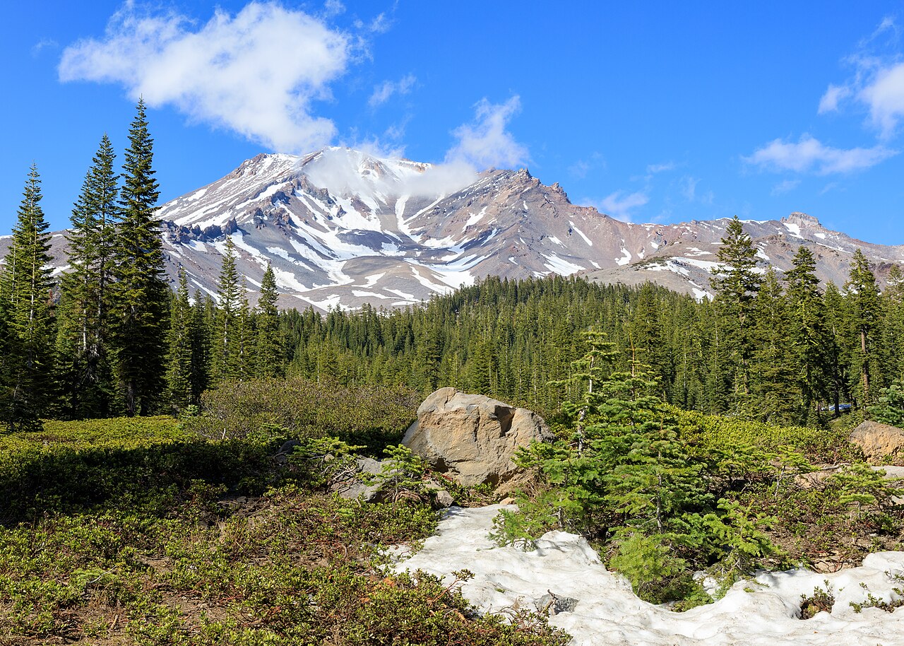
Frank Schulenburg · CC BY-SA 4.0 · Original file and attribution
Wikimedia-generated thumbnail; no atlas crop or color edits. Photograph date: 2021-05-09 16:45:46.
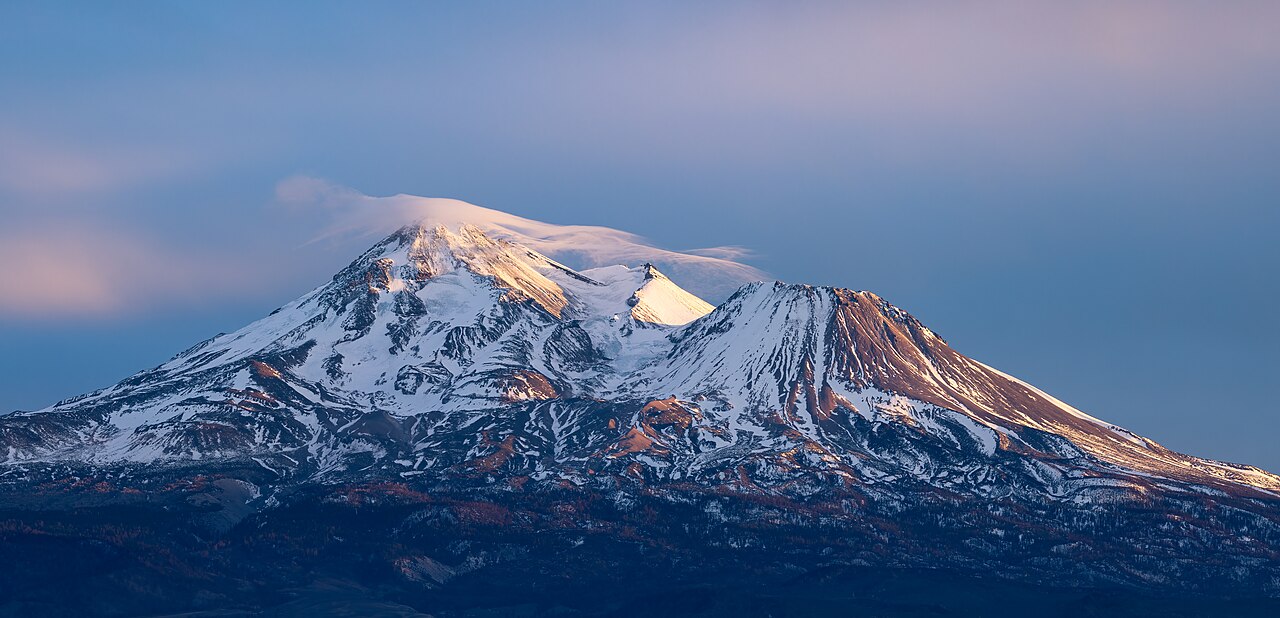
Frank Schulenburg · CC BY-SA 4.0 · Original file and attribution
Wikimedia-generated thumbnail; no atlas crop or color edits. Photograph date: 2022-01-30 17:12:58.
Explore this place
- Read the mountain through its overlapping volcanic cones.
- Compare the south-side climbing routes with the north-side glaciers.
- Follow USGS monitoring and the official climbing advisory.
Read the land
An exposed high-alpine summit and plateau. Every summit approach leaves ordinary hiking trails and involves changing mountain conditions.
Planning, access and history
Access and permits
No developed trail reaches the summit. The Forest Service requires a wilderness permit for wilderness entry and a summit pass for travel above 10,000 feet.
Geology
USGS identifies Shastina and Hotlum as Holocene eruptive centers and Black Butte as a group of younger flank lava domes.
Plan with a permitted guide
VisitShasta recommends a permitted professional mountain guide for every summit attempt. This is our safety policy, not a claim that a guide is legally required. Discuss the route, conditions, skills, emergency plan and turnaround decisions before booking; a guide cannot remove all mountain risk.
Terrain and hazards
Summit routes can be fatal
Steep snow and ice, loose volcanic scree and talus, falling rock, extreme weather and a wrong descent into another drainage can have fatal consequences. A map line cannot establish a safe route; equipment only helps when the party has the skills to use it.
Volcanic context
Volcanic hazard maps show long-term scenarios, not the likelihood of an eruption today. Check USGS monitoring for current volcanic activity. A normal volcanic alert level does not establish safe hiking, stable snow or secure footing.
Original sources
Read articles and official documents at their publishers. “Page checked” records a retrieval or metadata check, not confirmation that every statement remains current. Older observations and reports are historical context.
- Current climbing advisory
Mount Shasta Avalanche Center · Conditions
Editorial review: November 1, 2026 at 04:58 UTC · Page checked: November 1, 2026 at 04:58 UTC
Open the original publisher for current conditions
- Climbing Mount Shasta · frequently asked questions
Mount Shasta Avalanche Center · Official
Editorial review: November 1, 2026 at 04:58 UTC · Page checked: November 1, 2026 at 04:58 UTC
Static reference; recheck access, fees and rules before travel
- Avalanche Gulch · route description
Mount Shasta Avalanche Center · Official
Editorial review: November 1, 2026 at 04:58 UTC · Page checked: November 1, 2026 at 04:58 UTC
Static reference; recheck access, fees and rules before travel
- Green Butte Ridge Trail
Hike Mt. Shasta · Local Guide
Page checked: November 1, 2026 at 04:59 UTC
- Clear Creek Trail
Hike Mt. Shasta · Local Guide
Page checked: November 1, 2026 at 04:59 UTC
- Brewer Creek Trail
Hike Mt. Shasta · Local Guide
Page checked: November 1, 2026 at 04:59 UTC
- Observations
Mount Shasta Avalanche Center · Official
Page checked: November 1, 2026 at 04:59 UTC
- South Gate Meadows
Mount Shasta Trail Association · Local Guide
Page checked: November 1, 2026 at 04:59 UTC
- North Side
Mount Shasta Avalanche Center · Official
Page checked: November 1, 2026 at 04:59 UTC
- Horse Camp Trail
Hike Mt. Shasta · Local Guide
Page checked: November 1, 2026 at 04:59 UTC
- Wilderness Ethics
US Forest Service · Official
Page checked: November 1, 2026 at 04:59 UTC
- Mount Shasta as seen from Bunny Flat.jpg · image and license
Wikimedia Commons · Photography
Page checked: November 1, 2026 at 04:59 UTC
- Education
Mount Shasta Avalanche Center · Official
Page checked: November 1, 2026 at 04:59 UTC
- Eddies - Castle Lake (5870 ft)
Mount Shasta Avalanche Center · Conditions
Page checked: November 1, 2026 at 04:59 UTC
- Share on Pinterest (Opens in new window) Pinterest
Hike Mt. Shasta · Local Guide
Page checked: November 1, 2026 at 04:59 UTC
- North Gate Trail
Hike Mt. Shasta · Local Guide
Page checked: November 1, 2026 at 04:59 UTC
- Email List Signup
Mount Shasta Avalanche Center · Official
Page checked: November 1, 2026 at 04:59 UTC
- Wilderness
US Forest Service · Official
Page checked: November 1, 2026 at 04:59 UTC
- Gray Butte Trail
Hike Mt. Shasta · Local Guide
Page checked: November 1, 2026 at 04:59 UTC
- Ash Creek Butte - Bowl (7250 ft)
Mount Shasta Avalanche Center · Conditions
Page checked: November 1, 2026 at 04:59 UTC
- Avalanche I
Mount Shasta Avalanche Center · Official
Page checked: November 1, 2026 at 04:59 UTC
- Ash Creek Butte - Ridge (7895 ft)
Mount Shasta Avalanche Center · Conditions
Page checked: November 1, 2026 at 04:59 UTC
- South Gate/Squaw Meadow Trail
Hike Mt. Shasta · Local Guide
Page checked: November 1, 2026 at 04:59 UTC
- Archives
Mount Shasta Avalanche Center · Conditions
Page checked: November 1, 2026 at 04:59 UTC
- Whitney Falls Trail
Hike Mt. Shasta · Local Guide
Page checked: November 1, 2026 at 04:59 UTC
- Panther Meadow Trail
Hike Mt. Shasta · Local Guide
Page checked: November 1, 2026 at 04:59 UTC
- Eddies - Mount Eddy (6509 ft)
Mount Shasta Avalanche Center · Conditions
Page checked: November 1, 2026 at 04:59 UTC
- Gear Lists
Mount Shasta Avalanche Center · Official
Page checked: November 1, 2026 at 04:59 UTC
- Mount Shasta Trails
Hike Mt. Shasta · Local Guide
Page checked: November 1, 2026 at 04:59 UTC
- Mt Shasta City (3540 ft)
Mount Shasta Avalanche Center · Conditions
Page checked: November 1, 2026 at 04:59 UTC
- North face of Mount Shasta at sunset-2175.jpg · image and license
Wikimedia Commons · Photography
Page checked: November 1, 2026 at 04:59 UTC
- Shasta · Global Volcanism Program
Smithsonian Institution · Research
Editorial review: November 1, 2026 at 04:58 UTC · Page checked: November 1, 2026 at 04:58 UTC
Static reference; recheck access, fees and rules before travel
- Mt. Shasta Wilderness & Climbing
US Forest Service · Official
Editorial review: November 1, 2026 at 04:58 UTC · Page checked: November 1, 2026 at 04:58 UTC
Static reference; recheck access, fees and rules before travel
- Geology and history of Mount Shasta
US Geological Survey · Research
Published: November 6, 2023 · Editorial review: November 1, 2026 at 04:58 UTC · Page checked: November 1, 2026 at 04:58 UTC
Static reference; recheck access, fees and rules before travel
- Mount Shasta · volcanic hazards summary
US Geological Survey · Research
Page checked: November 1, 2026 at 04:58 UTC
Static reference; recheck access, fees and rules before travel
- Mount Shasta · volcano monitoring and science
US Geological Survey · Research
Editorial review: November 1, 2026 at 09:13 UTC · Page checked: November 1, 2026 at 04:58 UTC
Static reference; recheck access, fees and rules before travel
- Mount Shasta
Wikipedia contributors · Encyclopedia
Editorial review: November 1, 2026 at 04:58 UTC · Page checked: November 1, 2026 at 04:58 UTC
Static reference; recheck access, fees and rules before travel
- Mount Shasta Wilderness
Wikipedia contributors · Encyclopedia
Page checked: November 1, 2026 at 04:58 UTC
Static reference; recheck access, fees and rules before travel

