
THE MOUNTAIN, DOCUMENTED
Northgate Trailhead
A quieter doorway to the glacier-draped north face.
Northgate approaches the Hotlum–Bolam side of Mount Shasta. A forested trail climbs toward high camp, beyond which the landscape becomes steep snow, ice and glacier terrain.
Explore Northgate Trailhead in 3D ↗Editorial review: November 1, 2026 at 04:58 UTC. Source dates vary.
By the VisitShasta.org editorial team · Send a correction
This guide preserves a dated review. Confirm current road access, land-manager orders, weather and snow conditions with the original sources. A mapped route does not establish legal access or safety. Open the atlas conditions desk for separately dated live products.
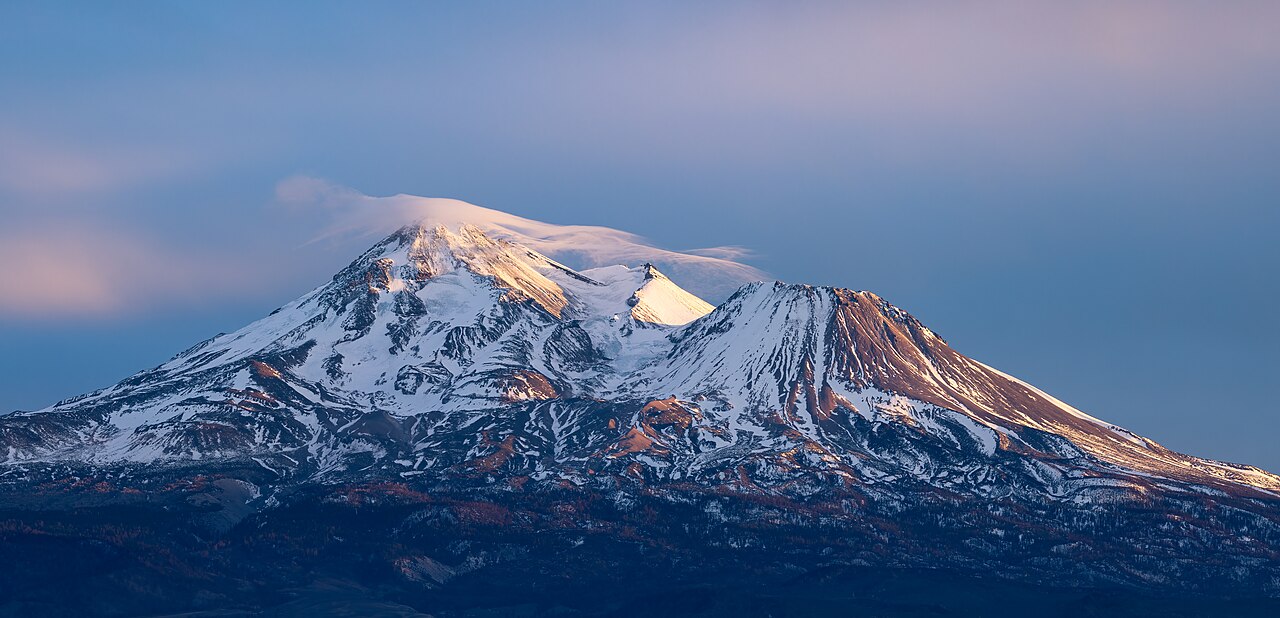
Frank Schulenburg · CC BY-SA 4.0 · Original file and attribution
Wikimedia-generated thumbnail; no atlas crop or color edits. Photograph date: 2022-01-30 17:12:58.
Explore this place
- See Hotlum and Bolam from their approach side.
- Distinguish the hiking approach from glacier travel.
- Trace the rough road in from Military Pass.
Read the land
Red-fir forest, krummholz and exposed alpine slopes below the north-side glaciers.
Planning, access and history
Road approach
MSAC describes about 8.5 miles of rough dirt road from Military Pass Road, recommending moderate to high ground clearance. Seasonal access requires a fresh check.
Upper trail
MSAC places the established approach’s upper camp near 9,800 feet and advises unequipped day hikers to turn around before glacier and steep-snow terrain. Treat any seasonal stream water.
Terrain and hazards
Glacier transition
A path drawn on a map does not remove crevasse, icefall, navigation or avalanche hazards above the approach. Consult the specific official route description.
Original sources
Read articles and official documents at their publishers. “Page checked” records a retrieval or metadata check, not confirmation that every statement remains current. Older observations and reports are historical context.
- Current climbing advisory
Mount Shasta Avalanche Center · Conditions
Editorial review: November 1, 2026 at 04:58 UTC · Page checked: November 1, 2026 at 04:58 UTC
Open the original publisher for current conditions
- Official avalanche forecast
Mount Shasta Avalanche Center · Conditions
Editorial review: November 1, 2026 at 04:58 UTC · Page checked: November 1, 2026 at 04:58 UTC
Open the original publisher for current conditions
- Northgate · trailhead access guide
Mount Shasta Avalanche Center · Official
Editorial review: November 1, 2026 at 04:58 UTC · Page checked: November 1, 2026 at 04:58 UTC
Static reference; recheck access, fees and rules before travel
- Wintun Ridge
Mount Shasta Avalanche Center · Official
Page checked: November 1, 2026 at 04:59 UTC
- Bolam / Whitney Ridge
Mount Shasta Avalanche Center · Official
Page checked: November 1, 2026 at 04:59 UTC
- Wintun Glacier
Mount Shasta Avalanche Center · Official
Page checked: November 1, 2026 at 04:59 UTC
- Hotlum Glacier
Mount Shasta Avalanche Center · Official
Page checked: November 1, 2026 at 04:59 UTC
- Whitney Glacier
Mount Shasta Avalanche Center · Official
Page checked: November 1, 2026 at 04:59 UTC
- Hotlum / Bolam Ridge
Mount Shasta Avalanche Center · Official
Page checked: November 1, 2026 at 04:59 UTC
- North face of Mount Shasta at sunset-2175.jpg · image and license
Wikimedia Commons · Photography
Page checked: November 1, 2026 at 04:59 UTC
- Bolam Glacier
Wikipedia contributors · Encyclopedia
Page checked: November 1, 2026 at 04:58 UTC
Static reference; recheck access, fees and rules before travel
- Hotlum Glacier
Wikipedia contributors · Encyclopedia
Page checked: November 1, 2026 at 04:58 UTC
Static reference; recheck access, fees and rules before travel
- Whitney Glacier
Wikipedia contributors · Encyclopedia
Page checked: November 1, 2026 at 04:58 UTC
Static reference; recheck access, fees and rules before travel
