
THE MOUNTAIN, DOCUMENTED
Bunny Flat
The south-side gateway, where the mountain begins to feel immense.
This busy trailhead on Everitt Memorial Highway launches day hikes toward Horse Camp and climbing approaches to Shasta’s south and west sides. It also serves winter visitors when the upper road is gated.
READ BEFORE PLANNING THIS OUTING
Mountain approach · conditions can change the trip
- A summer approach can become snow, ice and avalanche travel in winter. Check the road gate, forecast, daylight and land-manager notices before departure.
- Continuing above an approach trailhead or Horse Camp toward Helen Lake or the summit enters a different class of mountain terrain.
VisitShasta recommends: do not attempt the summit without a qualified, permitted professional mountain guide.
A mapped line, a low grade, clear weather or an unavailable alert feed does not establish safe travel. Hazards are incomplete and conditions change.
Emergency: call 911 when available or use your satellite device’s SOS. Rescue may be delayed or impossible.
Original hazard and conditions sources
Editorial warning reviewed November 1, 2026. Check the issue and validity dates on the official products.
Editorial review: November 1, 2026 at 09:13 UTC. Source dates vary.
By the VisitShasta.org editorial team · Send a correction
This guide preserves a dated review. Confirm current road access, land-manager orders, weather and snow conditions with the original sources. A mapped route does not establish legal access or safety. Open the atlas conditions desk for separately dated live products.
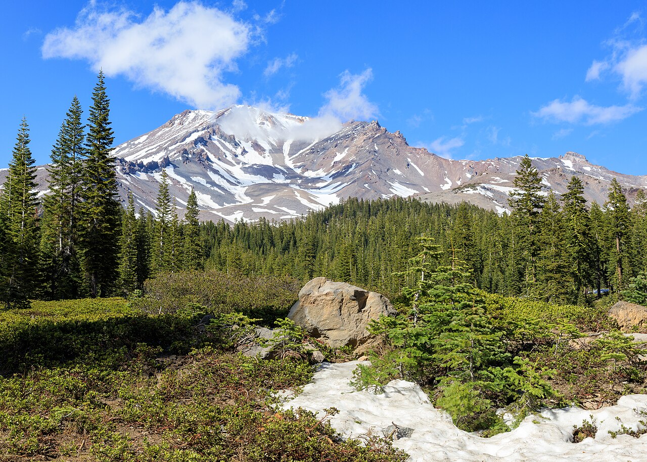
Frank Schulenburg · CC BY-SA 4.0 · Original file and attribution
Wikimedia-generated thumbnail; no atlas crop or color edits. Photograph date: 2021-05-09 16:45:46.
Explore this place
- Hike toward the stone cabin at Horse Camp.
- Explore the Snow Bunny connection toward the Old Ski Bowl.
- Check mountain conditions before leaving the road.
Read the land
Subalpine forest and open snow meadows at the road’s winter turning point, beneath Avalanche Gulch.
Planning, access and history
Trailhead basics
MSAC lists toilets, self-issued wilderness permits, summit passes and human-waste pack-out bags. There is no trailhead water. Seasonal springs farther uphill may be buried by snow.
Dispersed camping
MSAC directs dispersed campers to the downhill side of the road rather than Bunny Flat above it. Check current forest orders and fire restrictions.
Terrain and hazards
Snow changes the trip
Summer approach trails can become winter travel. The gate above Bunny Flat is seasonal; an open lower road does not establish access to Panther Meadows or the bowl. Snow-covered routes require a separate terrain, weather and avalanche assessment.
Original sources
Read articles and official documents at their publishers. “Page checked” records a retrieval or metadata check, not confirmation that every statement remains current. Older observations and reports are historical context.
- Visitor information and dated road updates
Mount Shasta Chamber of Commerce · Local Guide
Editorial review: November 1, 2026 at 04:58 UTC · Page checked: November 1, 2026 at 04:58 UTC
Static reference; recheck access, fees and rules before travel
- Current climbing advisory
Mount Shasta Avalanche Center · Conditions
Editorial review: November 1, 2026 at 04:58 UTC · Page checked: November 1, 2026 at 04:58 UTC
Open the original publisher for current conditions
- Climbing Mount Shasta · frequently asked questions
Mount Shasta Avalanche Center · Official
Editorial review: November 1, 2026 at 04:58 UTC · Page checked: November 1, 2026 at 04:58 UTC
Static reference; recheck access, fees and rules before travel
- Bunny Flat · trailhead access guide
Mount Shasta Avalanche Center · Official
Editorial review: November 1, 2026 at 04:58 UTC · Page checked: November 1, 2026 at 04:58 UTC
Static reference; recheck access, fees and rules before travel
- Ski Bowl · trailhead access guide
Mount Shasta Avalanche Center · Official
Editorial review: November 1, 2026 at 04:58 UTC · Page checked: November 1, 2026 at 04:58 UTC
Static reference; recheck access, fees and rules before travel
- Mount Shasta as seen from Bunny Flat.jpg · image and license
Wikimedia Commons · Photography
Page checked: November 1, 2026 at 04:59 UTC
- Forest alerts, restrictions and orders
US Forest Service · Conditions
Editorial review: November 1, 2026 at 04:58 UTC · Page checked: November 1, 2026 at 04:58 UTC
Open the original publisher for current conditions
- Bunny Flat · Forest Service trail guide
US Forest Service · Official
Editorial review: November 1, 2026 at 04:58 UTC · Page checked: November 1, 2026 at 04:58 UTC
Static reference; recheck access, fees and rules before travel
