
THE MOUNTAIN, DOCUMENTED
Black Butte
A volcanic dome complex with a serious trail-maintenance warning.
Black Butte’s overlapping lava domes rise between Mount Shasta and Interstate 5. The historic trail spirals toward the old lookout foundation, but current maintenance guidance deserves attention before any hike.
Explore Black Butte in 3D ↗Editorial review: November 1, 2026 at 04:58 UTC. Source dates vary.
By the VisitShasta.org editorial team · Send a correction
This guide preserves a dated review. Confirm current road access, land-manager orders, weather and snow conditions with the original sources. A mapped route does not establish legal access or safety. Open the atlas conditions desk for separately dated live products.
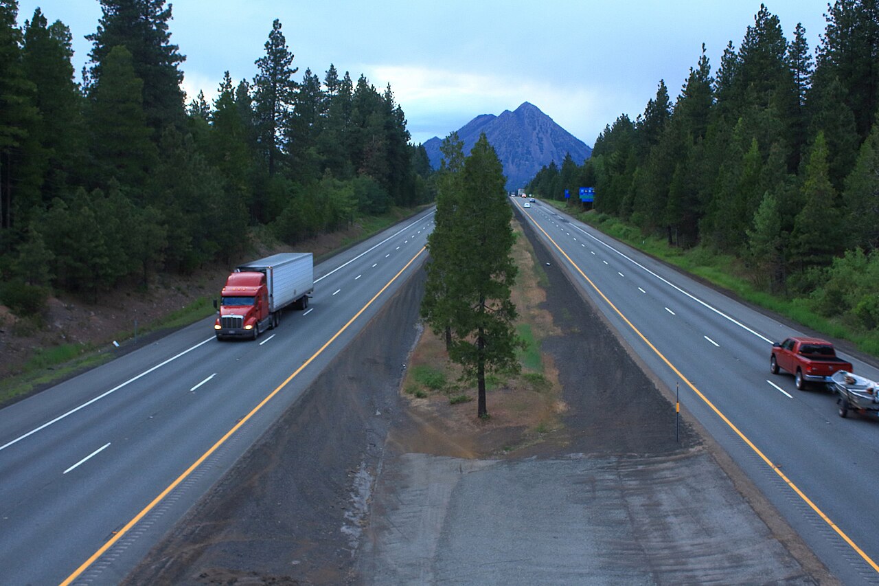
Karthik.rao.n · CC BY-SA 3.0 · Original file and attribution
Wikimedia-generated thumbnail; no atlas crop or color edits. Photograph date: 2013-05-25.
Explore this place
- Understand the overlapping dome geology.
- Read the trail association’s condition warning first.
- Explore the former lookout’s history.
Read the land
Steep, blocky volcanic talus with little shade and very limited off-trail alternatives.
Dated notices and source conflicts
Warning has no visible issue date
The association warning was present when reviewed, but its page does not establish a recent inspection date. Contact the land manager for current conditions.
Planning, access and history
Trail scale
The older Forest Service brochure gives about 2.56 miles one way, 1,845 feet of climbing and no trail water. Its 2010 revision is historical guidance, not a current maintenance inspection.
Volcanic history
USGS describes Black Butte as overlapping dacite domes erupted roughly 9,500 years ago, associated with pyroclastic flows.
Terrain and hazards
Damaged retaining wall
The Trail Association reports a partially failed wire-basket retaining wall with material across and hanging above the trail, and says it no longer endorses hiking this route. This is a maintenance warning, not a verified legal closure.
Original sources
Read articles and official documents at their publishers. “Page checked” records a retrieval or metadata check, not confirmation that every statement remains current. Older observations and reports are historical context.
- Black Butte · trail association maintenance warning
Mount Shasta Trail Association · Local Guide
Editorial review: November 1, 2026 at 04:58 UTC · Page checked: November 1, 2026 at 04:58 UTC
Static reference; recheck access, fees and rules before travel
- Black Butte seen from I-5 near Shasta City.jpg · image and license
Wikimedia Commons · Photography
Page checked: November 1, 2026 at 04:59 UTC
- Black Butte Trail · agency brochure (revised 2010)
US Forest Service · Official
Editorial review: November 1, 2026 at 04:58 UTC · Page checked: November 1, 2026 at 04:58 UTC
Static reference; recheck access, fees and rules before travel
- Black Butte Trail · Forest Service trail guide
US Forest Service · Official
Page checked: November 1, 2026 at 04:58 UTC
Static reference; recheck access, fees and rules before travel
- Geology and history of Mount Shasta
US Geological Survey · Research
Published: November 6, 2023 · Editorial review: November 1, 2026 at 04:58 UTC · Page checked: November 1, 2026 at 04:58 UTC
Static reference; recheck access, fees and rules before travel
- Black Butte (Siskiyou County, California)
Wikipedia contributors · Encyclopedia
Editorial review: November 1, 2026 at 04:58 UTC · Page checked: November 1, 2026 at 04:58 UTC
Static reference; recheck access, fees and rules before travel
