
THE MOUNTAIN, DOCUMENTED
Lake Siskiyou
Shoreline paths and the mountain reflected across the water.
A reservoir on the Sacramento River provides a popular low-elevation shoreline trail and Mount Shasta views. Completing the loop depends on seasonal bridges across the river delta.
Explore Lake Siskiyou in 3D ↗Editorial review: November 1, 2026 at 04:58 UTC. Source dates vary.
By the VisitShasta.org editorial team · Send a correction
This guide preserves a dated review. Confirm current road access, land-manager orders, weather and snow conditions with the original sources. A mapped route does not establish legal access or safety. Open the atlas conditions desk for separately dated live products.
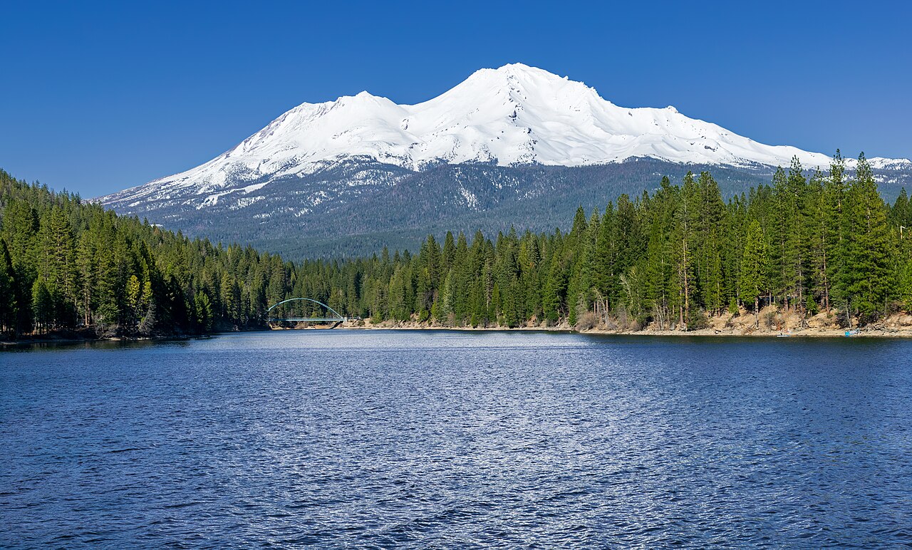
Radomianin · CC BY-SA 4.0 · Original file and attribution
Wikimedia-generated thumbnail; no atlas crop or color edits. Photograph date: Taken on 16 March 2024, 16:26:33.
Explore this place
- Compare a short shore walk with the full loop.
- Locate the seasonal delta bridges before setting out.
- Find mountain viewpoints along the north and west shores.
Read the land
Woodland, shoreline and delta crossings with a mostly gentle trail and several access points.
Planning, access and history
Loop scale
The Trail Association describes a roughly seven-mile loop with little climbing and leashed dogs allowed. Shore walks remain possible when the seasonal delta connection is absent.
Bridge status
The delta bridges are seasonal. The county page’s visible removal notice is dated November 8, 2024; the trail guide also has an older January note. Neither establishes today’s crossing status. Confirm with the county before planning a loop.
Original sources
Read articles and official documents at their publishers. “Page checked” records a retrieval or metadata check, not confirmation that every statement remains current. Older observations and reports are historical context.
- Lake Siskiyou · Flood Control and Water Conservation District
Siskiyou County · Official
Editorial review: November 1, 2026 at 04:58 UTC · Page checked: November 1, 2026 at 05:01 UTC
Static reference; recheck access, fees and rules before travel
- Lake Siskiyou Trail Loop · seasonal bridge context
Mount Shasta Trail Association · Local Guide
Editorial review: November 1, 2026 at 04:58 UTC · Page checked: November 1, 2026 at 04:58 UTC
Static reference; recheck access, fees and rules before travel
- Mount Shasta, Lake Siskiyou, SW view.jpg · image and license
Wikimedia Commons · Photography
Page checked: November 1, 2026 at 04:59 UTC
- Lake Siskiyou
Wikipedia contributors · Encyclopedia
Editorial review: November 1, 2026 at 04:58 UTC · Page checked: November 1, 2026 at 04:58 UTC
Static reference; recheck access, fees and rules before travel
